
Topografische Karte Meszna
Interaktive Karte
Klicken Sie auf die Karte, um die Höhe anzuzeigen.
Über diese Karte
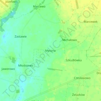
Name: Topografische Karte Meszna, Höhe, Relief.
Durchschnittliche Höhe: 99 m
Minimale Höhe: 90 m
Maximale Höhe: 108 m
Andere topografische Karten
Klicken Sie auf eine Karte, um ihre Topografie, ihre Höhe und ihr Relief anzuzeigen.
Młodojewo-Parcele
Poland > Greater Poland Voivodeship > Słupca County
Młodojewo-Parcele, gmina Słupca, Słupca County, Greater Poland Voivodeship, 62-400, Poland
Durchschnittliche Höhe: 97 m
Bielsko
Poland > Greater Poland Voivodeship > Słupca County
Bielsko, gmina Orchowo, Słupca County, Greater Poland Voivodeship, 62-436, Poland
Durchschnittliche Höhe: 107 m
Róża
Poland > Greater Poland Voivodeship > Słupca County
Róża, gmina Słupca, Słupca County, Greater Poland Voivodeship, 62-400, Poland
Durchschnittliche Höhe: 94 m
Powidz
Poland > Greater Poland Voivodeship > Słupca County
Powidz, gmina Powidz, Słupca County, Greater Poland Voivodeship, 62-430, Poland
Durchschnittliche Höhe: 107 m