Geolokalisieren

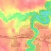
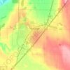
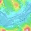
Topografische Karte Mons Lake

Klicken Sie auf die Karte, um die Höhe anzuzeigen.

Über diese Karte

Name: Topografische Karte Mons Lake, Höhe, Relief.

Ort: Mons Lake, Smoky Lake County, Alberta, Canada (54.18033 -112.37640 54.19954 -112.34564)

Durchschnittliche Höhe: 620 m

Minimale Höhe: 602 m

Maximale Höhe: 683 m

Andere topografische Karten

Klicken Sie auf eine Karte, um ihre Topografie, ihre Höhe und ihr Relief anzuzeigen.
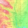
Calgary

Canada > Alberta

Calgary, Alberta, is uniquely positioned in the transition zone between the rolling Canadian Prairies to the east and the rugged foothills of the Canadian Rockies to the west, creating a landscape of undulating hills, plateau-like uplands, and deep river valleys. The Bow and Elbow Rivers carve prominent bluffs…

Durchschnittliche Höhe: 1.106 m
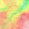
Edmonton

Canada > Alberta

Edmonton is on the North Saskatchewan River, at an elevation of 671 m (2,201 ft). It is North America's northernmost city with a metropolitan population over one million. It is at the same latitude as Hamburg (Germany); Dublin (Ireland); Manchester (United Kingdom); and Magnitogorsk (Russia). It is south of…

Durchschnittliche Höhe: 690 m
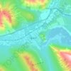
Banff

Canada > Alberta > Banff > Banff

Banff is a town within Banff National Park in Alberta, Canada. It is located in Alberta's Rockies along the Trans-Canada Highway, approximately 126 km (78 mi) west of Calgary and 58 km (36 mi) east of Lake Louise. At 1,400 to 1,630 m (4,590 to 5,350 ft) above sea level, Banff is the community with the second…

Durchschnittliche Höhe: 1.615 m

Rocky View County

Canada > Alberta

Durchschnittliche Höhe: 1.110 m

Evansburg

Canada > Alberta > Division No. 14

Durchschnittliche Höhe: 769 m

Nihahi Ridge

Canada > Alberta

Durchschnittliche Höhe: 2.133 m

Edmonton

Canada > Alberta > Edmonton

Durchschnittliche Höhe: 677 m

Banff

Canada > Alberta

Banff is a town within Banff National Park in Alberta, Canada. It is located in Alberta's Rockies along the Trans-Canada Highway, approximately 126 km (78 mi) west of Calgary and 58 km (36 mi) east of Lake Louise. At 1,400 to 1,630 m (4,590 to 5,350 ft) above sea level, Banff is the community with the second…

Durchschnittliche Höhe: 1.421 m

Town of Sylvan Lake

Canada > Alberta

Durchschnittliche Höhe: 958 m

Grande Prairie

Canada > Alberta > Grande Prairie

Grande Prairie is located just north of the 55th parallel north, and is 465 km (289 mi) northwest of Edmonton, lying at an elevation of 669 m (2,195 ft) above sea level. The city is surrounded by farmland to the north, east, and west. To the south lies a vast boreal forest with aspen, tamarack, lodgepole pine,…

Durchschnittliche Höhe: 668 m
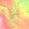
Lethbridge

Canada > Alberta > Lethbridge

Its high elevation of 929 m (3,047.9 ft) and close proximity to the Rocky Mountains provides Lethbridge with cooler summers than other locations in the Canadian Prairies. These factors protect the city from strong northwest and southwest winds and contribute to frequent chinook winds during the winter.…

Durchschnittliche Höhe: 918 m
Drayton Valley

Canada > Alberta > Drayton Valley

Durchschnittliche Höhe: 840 m

Rocky Mountain House

Canada > Alberta > Rocky Mountain House

Rocky Mountain House has a subarctic climate (Köppen climate classification Dfc) that borders on a humid continental climate (Köppen Dfb). Daytime temperatures are in general representative for the latter, but the larger diurnal temperature variation with the high elevation ensures frequent frosts. The…

Durchschnittliche Höhe: 988 m
Priddis

Canada > Alberta > Foothills County

Priddis is a hamlet in Alberta, Canada within Foothills County. It is located in the foothills of the Canadian Rockies at an elevation of 1,160 metres (3,810 ft). The hamlet is located southwest of the intersection of the Cowboy Trail (Highway 22) and Highway 22X, approximately 10 kilometres (6.2 mi) west of…

Durchschnittliche Höhe: 1.193 m

Tombstone Mountain

Canada > Alberta

Durchschnittliche Höhe: 2.394 m

Ministik Lake Game Bird Sanctuary

Canada > Alberta

Durchschnittliche Höhe: 769 m

Johnston Canyon

Canada > Alberta

Durchschnittliche Höhe: 1.530 m

Rocky Mountains

Canada > Alberta > Clearwater County

Durchschnittliche Höhe: 2.541 m

Sundre

Canada > Alberta > Town of Sundre

Durchschnittliche Höhe: 1.127 m

Strathmore

Canada > Alberta

Durchschnittliche Höhe: 973 m

St. Albert

Canada > Alberta

Durchschnittliche Höhe: 677 m

Fort McMurray

Canada > Alberta > Wood Buffalo

The community lies at a lower elevation than most other parts of Alberta, so under the right conditions it can be a "hot spot" for Alberta.

Durchschnittliche Höhe: 345 m
Red Deer

Canada > Alberta > Red Deer

Durchschnittliche Höhe: 918 m

Eagle Hill

Canada > Alberta > Division No. 15

Durchschnittliche Höhe: 1.576 m

Innisfail

Canada > Alberta > Town of Innisfail

Durchschnittliche Höhe: 942 m

Clearwater County

Canada > Alberta

Durchschnittliche Höhe: 1.443 m

Foothills County

Canada > Alberta

Durchschnittliche Höhe: 1.196 m

Medicine Hat

Canada > Alberta

Durchschnittliche Höhe: 708 m

County of Barrhead

Canada > Alberta

Durchschnittliche Höhe: 743 m

Protection Mountain

Canada > Alberta

Durchschnittliche Höhe: 2.536 m

Mount Glasgow

Canada > Alberta

Durchschnittliche Höhe: 2.438 m

Bow Island (town)

Canada > Alberta

Durchschnittliche Höhe: 845 m

Grande Prairie (city)

Canada > Alberta

Durchschnittliche Höhe: 761 m

Fort Assiniboine

Canada > Alberta > Woodlands County

Durchschnittliche Höhe: 632 m

Wainwright

Canada > Alberta > Wainwright

Durchschnittliche Höhe: 685 m

Village of Innisfree

Canada > Alberta > Division No. 10

Durchschnittliche Höhe: 679 m

Banff National Park

Canada > Alberta

Banff National Park has a subarctic climate with three ecoregions, including montane, subalpine, and alpine. The forests are dominated by Lodgepole pine at lower elevations and Engelmann spruce in higher ones below the treeline, above which is primarily rocks and ice. Mammal species such as the grizzly bear,…

Durchschnittliche Höhe: 1.848 m

Jasper National Park

Canada > Alberta

Durchschnittliche Höhe: 1.782 m

Edmonton

Canada > Alberta > Edmonton

Durchschnittliche Höhe: 658 m

Calgary

Canada > Alberta > Calgary

Durchschnittliche Höhe: 1.106 m

Exshaw

Canada > Alberta > Municipal District of Bighorn

Durchschnittliche Höhe: 1.420 m

Yellowhead County

Canada > Alberta

Durchschnittliche Höhe: 1.257 m

Canmore (town)

Canada > Alberta

Durchschnittliche Höhe: 1.780 m

Caroline

Canada > Alberta

Durchschnittliche Höhe: 1.066 m

Village of Longview

Canada > Alberta

Durchschnittliche Höhe: 1.241 m

Siffleur Falls

Canada > Alberta

Durchschnittliche Höhe: 1.511 m

Majeau Lake

Canada > Alberta

Durchschnittliche Höhe: 685 m

Mount Head

Canada > Alberta

Durchschnittliche Höhe: 2.309 m

Drumheller

Canada > Alberta

Durchschnittliche Höhe: 809 m

Fisher Peak

Canada > Alberta

Durchschnittliche Höhe: 2.531 m

Town of Athabasca

Canada > Alberta

Durchschnittliche Höhe: 566 m

Edson

Canada > Alberta

Edson lies in the McLeod River valley, immediately east of the Canadian Rockies foothills. The surrounding landscape consists of primarily taiga forest with sand hills and muskeg. The town is located at an altitude of 925 metres (3,035 ft). Two provincial parks are located west of Edson: Sundance Provincial…

Durchschnittliche Höhe: 928 m

White Man Mountain

Canada > Alberta

Durchschnittliche Höhe: 2.346 m

Fort Saskatchewan

Canada > Alberta

Durchschnittliche Höhe: 637 m

Athabasca Falls

Canada > Alberta

Durchschnittliche Höhe: 1.211 m

Barrhead

Canada > Alberta

Durchschnittliche Höhe: 733 m

Killam (town)

Canada > Alberta

Durchschnittliche Höhe: 721 m

Island Lake (summer village)

Canada > Alberta

Durchschnittliche Höhe: 646 m

Lamont

Canada > Alberta

Durchschnittliche Höhe: 670 m

Whitecourt (town)

Canada > Alberta

Durchschnittliche Höhe: 870 m

Edson (town)

Canada > Alberta

Durchschnittliche Höhe: 1.063 m

High Prairie (town)

Canada > Alberta

Durchschnittliche Höhe: 699 m

Hanna

Canada > Alberta

Durchschnittliche Höhe: 817 m

Redwater

Canada > Alberta > Town of Redwater

Durchschnittliche Höhe: 628 m

Valleyview (town)

Canada > Alberta

Durchschnittliche Höhe: 725 m

Onoway (town)

Canada > Alberta

Durchschnittliche Höhe: 729 m

Red Deer (city)

Canada > Alberta

Durchschnittliche Höhe: 924 m

Peace River (town)

Canada > Alberta

Durchschnittliche Höhe: 627 m

Circle Game Peak

Canada > Alberta

Durchschnittliche Höhe: 2.435 m

Mount Stelfox

Canada > Alberta

Durchschnittliche Höhe: 2.117 m

Division No. 10

Canada > Alberta

Durchschnittliche Höhe: 674 m

St. Albert

Canada > Alberta > St. Albert

Durchschnittliche Höhe: 681 m

Peace River

Canada > Alberta

Durchschnittliche Höhe: 434 m

Milk River

Canada > Alberta

Durchschnittliche Höhe: 1.195 m

Brazeau County

Canada > Alberta

Durchschnittliche Höhe: 910 m

Grande Cache

Canada > Alberta > Grande Cache

Durchschnittliche Höhe: 1.195 m

Horseshoe Bay

Canada > Alberta

Durchschnittliche Höhe: 649 m

Division No. 3

Canada > Alberta

Durchschnittliche Höhe: 1.290 m

Division No. 1

Canada > Alberta

Durchschnittliche Höhe: 853 m

Division No. 2

Canada > Alberta

Durchschnittliche Höhe: 913 m

Division No. 12

Canada > Alberta

Durchschnittliche Höhe: 621 m

Division No. 7

Canada > Alberta

Durchschnittliche Höhe: 727 m

Division No. 5

Canada > Alberta

Durchschnittliche Höhe: 944 m

Village of Warner

Canada > Alberta

Durchschnittliche Höhe: 1.016 m

Town of Falher

Canada > Alberta

Durchschnittliche Höhe: 581 m

Drumheller (town)

Canada > Alberta

Durchschnittliche Höhe: 857 m

Improvement District No. 13

Canada > Alberta

Durchschnittliche Höhe: 719 m

Municipal District of Provost

Canada > Alberta

Durchschnittliche Höhe: 699 m

Carbon

Canada > Alberta

Durchschnittliche Höhe: 812 m

Division No. 17

Canada > Alberta

Durchschnittliche Höhe: 581 m

Town of Fox Creek

Canada > Alberta

Fox Creek is a town in northwest Alberta, Canada. It is located on Highway 43, approximately 259 km (161 mi) northwest of Edmonton and 199 km (124 mi) southeast of Grande Prairie, and has an elevation of 808 m (2,651 ft).

Durchschnittliche Höhe: 824 m

Northern Sunrise County

Canada > Alberta

Durchschnittliche Höhe: 605 m

Division No. 11

Canada > Alberta

Durchschnittliche Höhe: 774 m

Village of Edgerton

Canada > Alberta

Durchschnittliche Höhe: 648 m

Fairview

Canada > Alberta

Durchschnittliche Höhe: 605 m

Whitecourt

Canada > Alberta

Whitecourt is a town in Northern Alberta, Canada that is surrounded by Woodlands County. It is approximately 177 km (110 mi) northwest of Edmonton and 279 km (173 mi) southeast of Grande Prairie at the junction of Highway 43 and Highway 32. It has an elevation of 690 m (2,260 ft).

Durchschnittliche Höhe: 719 m

Census Division No. 1

Canada > Alberta

Durchschnittliche Höhe: 853 m

Drumheller

Canada > Alberta > Drumheller

Durchschnittliche Höhe: 763 m

Census Division No. 3

Canada > Alberta

Durchschnittliche Höhe: 1.290 m

Wood Buffalo

Canada > Alberta

Durchschnittliche Höhe: 446 m

Rüsten Sie sich für Ihr nächstes Abenteuer:

📍GPS Geräte - Hand-GPS für Wandern, Radfahren und Orientierung
🥪Edelstahl Brotdose - Nachhaltige und robuste Aufbewahrung für die Brotzeit
🧴Fahrrad Kettenöl - Pflegemittel für einen reibungslosen Antrieb
🎙️Funkgeräte Set (Walkie-Talkies) - Kommunikation in Gebieten ohne Handyempfang
🦯Teleskop-Wanderstöcke - Leichte, verstellbare Stöcke zur Entlastung der Gelenke

Als Amazon-Partner verdient diese Website an qualifizierten Käufen, ohne dass Ihnen zusätzliche Kosten entstehen.