
Topografische Karte Montalvo
Interaktive Karte
Klicken Sie auf die Karte, um die Höhe anzuzeigen.
Über diese Karte
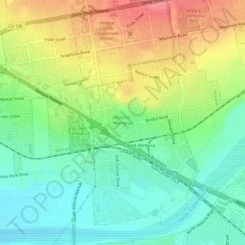
Name: Topografische Karte Montalvo, Höhe, Relief.
Durchschnittliche Höhe: 42 m
Minimale Höhe: 8 m
Maximale Höhe: 92 m
Andere topografische Karten
Klicken Sie auf eine Karte, um ihre Topografie, ihre Höhe und ihr Relief anzuzeigen.
Junipero Serra Park
United States > California > Ventura County > Ventura
Junipero Serra Park, Ventura, Ventura County, CAL Fire Southern Region, California, United States
Durchschnittliche Höhe: 49 m
Casitas Springs
United States > California > Ventura County > Ventura > Casitas Springs
Casitas Springs, Ventura, Ventura County, California, 93022, United States
Durchschnittliche Höhe: 182 m