
Topografische Karte Green Valley
Interaktive Karte
Klicken Sie auf die Karte, um die Höhe anzuzeigen.
Über diese Karte
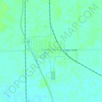
Name: Topografische Karte Green Valley, Höhe, Relief.
Ort: Green Valley, Tazewell County, Illinois, United States (40.39978 -89.65095 40.41426 -89.63381)
Durchschnittliche Höhe: 164 m
Minimale Höhe: 160 m
Maximale Höhe: 169 m
Andere topografische Karten
Klicken Sie auf eine Karte, um ihre Topografie, ihre Höhe und ihr Relief anzuzeigen.
Washington
United States > Illinois > Tazewell County
Washington, Tazewell County, Illinois, 61571, United States
Durchschnittliche Höhe: 236 m
Deer Creek
United States > Illinois > Tazewell County
Deer Creek, Tazewell County, Illinois, United States
Durchschnittliche Höhe: 227 m
East Peoria
United States > Illinois > Tazewell County
East Peoria, Tazewell County, Illinois, 61611, United States
Durchschnittliche Höhe: 176 m
Tazewell County
United States > Illinois > Tazewell County
Tazewell County, Illinois, United States
Durchschnittliche Höhe: 190 m
Morton
United States > Illinois > Tazewell County
Morton, Tazewell County, Illinois, 61550, United States
Durchschnittliche Höhe: 219 m