

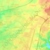
Topografische Karte Beauce
Klicken Sie auf die Karte, um die Höhe anzuzeigen.
Beauce
L'altitude moyenne est de 140 m.
Über diese Karte

Name: Topografische Karte Beauce, Höhe, Relief.
Ort: Beauce, Centre-Val de Loire, France métropolitaine, France (47.56518 0.96766 48.61793 2.43347)
Durchschnittliche Höhe: 136 m
Minimale Höhe: 36 m
Maximale Höhe: 286 m
Andere topografische Karten
Klicken Sie auf eine Karte, um ihre Topografie, ihre Höhe und ihr Relief anzuzeigen.

La Ville
France > Centre-Val de Loire > Indre-et-Loire > Chinon > La Ville
Durchschnittliche Höhe: 52 m

Malesherbes
France > Centre-Val de Loire > Loiret > Le Malesherbois
La superficie de la commune est de 1 761 hectares ; son altitude varie entre 67 et 140 mètres.
Durchschnittliche Höhe: 102 m


Pièce du Bois et des Fosses
France > Centre-Val de Loire > Indre > Saint-Maur > Villechaise
Durchschnittliche Höhe: 162 m

Hameau des Doucets
France > Centre-Val de Loire > Loiret > Beaulieu-sur-Loire > Hameau des Doucets
Durchschnittliche Höhe: 162 m

La Simaudière
France > Centre-Val de Loire > Indre-et-Loire > Sorigny > La Simaudière
Durchschnittliche Höhe: 99 m

Charbonnière
France > Centre-Val de Loire > Loiret > Saint-Jean-de-Braye
Durchschnittliche Höhe: 115 m

Orléans
France > Centre-Val de Loire > Loiret > Orléans
Orléans se trouve dans le coude septentrional de la Loire, qui la traverse d'est en ouest. La ville appartient au secteur de la vallée de la Loire situé entre Sully-sur-Loire et Chalonnes-sur-Loire, qui a été classé patrimoine mondial de l'humanité par l'UNESCO en l'an 2000. Dans les années 1960 a…
Durchschnittliche Höhe: 115 m

La Rousselière
France > Centre-Val de Loire > Indre-et-Loire > Civray-de-Touraine > La Rousselière
Durchschnittliche Höhe: 85 m


Haie-de-Champ
France > Centre-Val de Loire > Loir-et-Cher > Saint-Firmin-des-Prés
Durchschnittliche Höhe: 115 m


La Proutière
France > Centre-Val de Loire > Indre-et-Loire > Épeigné-sur-Dême
Durchschnittliche Höhe: 106 m

Le Petit Clos du Chêne Maillard
France > Centre-Val de Loire > Loiret > Saran
Durchschnittliche Höhe: 124 m
Château de Chambord
France > Centre-Val de Loire > Loir-et-Cher > Chambord > Le Bourg
Durchschnittliche Höhe: 86 m


Abbaye de Cornilly
France > Centre-Val de Loire > Loir-et-Cher > Le Controis-en-Sologne
Durchschnittliche Höhe: 111 m

Réserve naturelle des vallées de la Grand-Pierre et de Vitain
France > Centre-Val de Loire > Loir-et-Cher > Averdon > Villiers
Durchschnittliche Höhe: 106 m


La Plage
France > Centre-Val de Loire > Loir-et-Cher > Faverolles-sur-Cher
Durchschnittliche Höhe: 93 m
Le Bourg-Nord
France > Centre-Val de Loire > Loir-et-Cher > Châtillon-sur-Cher
Durchschnittliche Höhe: 91 m



La Grande Rue
France > Centre-Val de Loire > Indre-et-Loire > Rochecorbon
Durchschnittliche Höhe: 77 m


La Chapelle
France > Centre-Val de Loire > Loir-et-Cher > Chaumont-sur-Loire
Durchschnittliche Höhe: 86 m

La République
France > Centre-Val de Loire > Loir-et-Cher > Montrieux-en-Sologne
Durchschnittliche Höhe: 101 m

Île de Muides
France > Centre-Val de Loire > Loir-et-Cher > Muides-sur-Loire
Durchschnittliche Höhe: 84 m
Les Trois Cheminées
France > Centre-Val de Loire > Loiret > Lailly-en-Val
Durchschnittliche Höhe: 89 m


La Petite Carte
France > Centre-Val de Loire > Indre-et-Loire > Joué-lès-Tours
Durchschnittliche Höhe: 70 m

Les Pontonnières
France > Centre-Val de Loire > Loir-et-Cher > Valencisse
Durchschnittliche Höhe: 117 m
Beaulieu
France > Centre-Val de Loire > Eure-et-Loir > Donnemain-Saint-Mamès
Durchschnittliche Höhe: 127 m
Les Malvoisies
France > Centre-Val de Loire > Loir-et-Cher > Fontaine-les-Coteaux
Durchschnittliche Höhe: 129 m
Le Bouillon
France > Centre-Val de Loire > Loir-et-Cher > Saint-Hilaire-la-Gravelle
Durchschnittliche Höhe: 125 m
Les Dandillons
France > Centre-Val de Loire > Indre-et-Loire > Azay-le-Rideau
Durchschnittliche Höhe: 77 m


Chausseloup
France > Centre-Val de Loire > Indre-et-Loire > Chanceaux-sur-Choisille
Durchschnittliche Höhe: 96 m
La Terre de la Ceuille Roulée
France > Centre-Val de Loire > Indre-et-Loire > Langeais
Durchschnittliche Höhe: 89 m

Les Coutures
France > Centre-Val de Loire > Indre-et-Loire > La Ville-aux-Dames
Durchschnittliche Höhe: 57 m


La Foire de Saint-Roch
France > Centre-Val de Loire > Indre-et-Loire > Saint-Roch
Durchschnittliche Höhe: 96 m

Coteau des Verrons
France > Centre-Val de Loire > Indre-et-Loire > Noizay
Durchschnittliche Höhe: 74 m
Saint-Sulpice
France > Centre-Val de Loire > Indre-et-Loire > Chambourg-sur-Indre
Durchschnittliche Höhe: 90 m

Petit Beaumont
France > Centre-Val de Loire > Loir-et-Cher > Cour-Cheverny
Durchschnittliche Höhe: 88 m
Clos des Petits Chaumonniers
France > Centre-Val de Loire > Loiret > Olivet
Durchschnittliche Höhe: 101 m



La Croix Lotteau
France > Centre-Val de Loire > Loiret > Châtillon-Coligny
Durchschnittliche Höhe: 140 m
La petite Grange
France > Centre-Val de Loire > Loiret > Saint-Pryvé-Saint-Mesmin
Durchschnittliche Höhe: 97 m
Bourg de Lassay
France > Centre-Val de Loire > Loir-et-Cher > Lassay-sur-Croisne
Durchschnittliche Höhe: 100 m
Prés de Saint-Gervais
France > Centre-Val de Loire > Loir-et-Cher > Les Roches-l'Évêque
Durchschnittliche Höhe: 100 m
Le Cornet
France > Centre-Val de Loire > Eure-et-Loir > Saint-Lubin-de-la-Haye
Durchschnittliche Höhe: 126 m

Le Buisson
France > Centre-Val de Loire > Indre-et-Loire > Tauxigny-Saint-Bauld
Durchschnittliche Höhe: 97 m

Le Stade
France > Centre-Val de Loire > Indre-et-Loire > Montlouis-sur-Loire
Durchschnittliche Höhe: 59 m
Le Papillon
France > Centre-Val de Loire > Indre-et-Loire > Parçay-Meslay
Durchschnittliche Höhe: 103 m
