

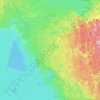
Topografische Karte Yellowhead
Klicken Sie auf die Karte, um die Höhe anzuzeigen.
Über diese Karte

Name: Topografische Karte Yellowhead, Höhe, Relief.
Ort: Yellowhead, Canada (51.61921 -120.00136 54.59048 -114.00134)
Durchschnittliche Höhe: 1.270 m
Minimale Höhe: 403 m
Maximale Höhe: 3.719 m
Andere topografische Karten
Klicken Sie auf eine Karte, um ihre Topografie, ihre Höhe und ihr Relief anzuzeigen.
Toronto
Despite its deep ravines, Toronto is not remarkably hilly, but its elevation does increase steadily away from the lake. Elevation differences range from 76.5 metres (251 ft) above sea level at the Lake Ontario shore to 209 m (686 ft) ASL near the York University grounds in the city's north end at the…
Durchschnittliche Höhe: 113 m
Peterborough
Canada > Ontario > Peterborough
Peterborough's topography is largely defined by land formations created by the receding Wisconsian glaciers 10,000–15,000 years ago. The South End and Downtown portions of the City sit on what was the bottom of the glacial Lake Peterborough—part of a glacial spillway created when glacial meltwaters from…
Durchschnittliche Höhe: 235 m
London
Canada > Ontario > London > London
London has a humid continental climate (Köppen Dfb), though due to its downwind location relative to Lake Huron and elevation changes across the city, it is virtually on the Dfa/Dfb (hot summer) boundary favouring the former climate zone to the southwest of the confluence of the South and North Thames Rivers,…
Durchschnittliche Höhe: 268 m
Guelph
This region of Ontario has cold winters and warm, humid summers, falling into the Köppen climate classification Dfb zone, with moderately high rainfall and snowfall. It is generally a couple of degrees cooler than lower elevation regions on the Great Lakes shorelines, especially so in winter, the exception…
Durchschnittliche Höhe: 344 m

Burnaby
Canada > British Columbia > Metro Vancouver Regional District > Burnaby
Burnaby occupies 98.60 square kilometres (38.07 sq mi) and is located at the geographic centre of the Metro Vancouver area and home to the Metro Vancouver regional government in Metrotown. Situated between the city of Vancouver on the west and Port Moody, Coquitlam, and New Westminster on the east, Burnaby is…
Durchschnittliche Höhe: 144 m
Banff
Canada > Alberta > Banff > Banff
Banff is a town within Banff National Park in Alberta, Canada. It is located in Alberta's Rockies along the Trans-Canada Highway, approximately 126 km (78 mi) west of Calgary and 58 km (36 mi) east of Lake Louise. At 1,400 to 1,630 m (4,590 to 5,350 ft) above sea level, Banff is the community with the second…
Durchschnittliche Höhe: 1.615 m

Laurentian Mountains
One of Quebec's official regions is called Laurentides. The mountain range runs through four other regions; Capitale-Nationale, Outaouais, Lanaudière, and Mauricie. The elevation generally ranges from around 500 m (1,640 ft) to 1,000 m (3,280 ft) with Mont Raoul-Blanchard being its highest peak, at 1,166 m…
Durchschnittliche Höhe: 348 m
Beaverdell
Canada > British Columbia > Regional District of Kootenay Boundary > Area E (Beaverdell/West Boundary)
Durchschnittliche Höhe: 956 m

Coquitlam
Canada > British Columbia > Metro Vancouver Regional District > Coquitlam
Southwest Coquitlam comprises the original core of the city, with Maillardville and Fraser River industrial sector giving way to the large residential areas of Austin Heights, colloquially referred to as "The Bump" due to its high and flat plateau topography. These older residences, with larger property…
Durchschnittliche Höhe: 230 m


Livingstone Range
Canada > Alberta > Municipal District of Ranchland No. 66
Durchschnittliche Höhe: 1.825 m


Wynndel
Canada > British Columbia > Regional District of Central Kootenay > Area A (Wynndel/Crawford Bay/Riondel)
Durchschnittliche Höhe: 712 m

Good Spirit Lake
Canada > Saskatchewan > Division No. 9 > Good Lake No. 274
Durchschnittliche Höhe: 481 m



Crescent Valley
Canada > British Columbia > Regional District of Central Kootenay > Area H (The Slocan Valley)
Durchschnittliche Höhe: 602 m


Knouff Lake
Canada > British Columbia > Thompson-Nicola Regional District > Area P (Rivers and the Peaks)
Durchschnittliche Höhe: 1.249 m

Panorama Ridge
Canada > British Columbia > Squamish-Lillooet Regional District > Area D (Elaho/Garibaldi)
Durchschnittliche Höhe: 1.786 m

Armstrong
Canada > British Columbia > Regional District of North Okanagan > Armstrong > Armstrong
Durchschnittliche Höhe: 494 m
Prince George
Canada > British Columbia > Regional District of Fraser-Fort George > Prince George
Durchschnittliche Höhe: 708 m


Royston
Canada > British Columbia > Comox Valley Regional District > Area A (Baynes Sound)
Durchschnittliche Höhe: 29 m

Millbrook
Canada > Ontario > Peterborough County > Cavan-Monaghan
Peterborough's topography is largely defined by land formations created by the receding Wisconsian glaciers 10,000–15,000 years ago. The South End and Downtown portions of the city sit on what was the bottom of the glacial Lake Peterborough—part of a glacial spillway created when glacial meltwaters from…
Durchschnittliche Höhe: 250 m
Goulais Bay
Canada > Ontario > Algoma District > Unorganized North Algoma
Durchschnittliche Höhe: 189 m


Mount Edziza
Canada > British Columbia > Regional District of Kitimat-Stikine > Area D (Iskut/Big Raven)
Mount Edziza (/ədˈzaɪzə/ əd-ZY-zə; Tahltan: Tenh Dẕetle [ten̥ ˈdðetle]) is a volcanic mountain in Cassiar Land District of northwestern British Columbia, Canada. It is located on the Big Raven Plateau of the Tahltan Highland which extends along the western side of the Stikine Plateau. Mount Edziza…
Durchschnittliche Höhe: 2.530 m

Mount Odin
Canada > Nunavut > Qikiqtaaluk Region
Mount Odin is the highest mountain within the Baffin Mountains as well as the fifth-highest in the Arctic Cordillera. It has a topographic prominence of 2,147 m (7,044 ft), greater than any other mountain within the Baffin Mountains and on Baffin Island, making Odin the third-highest mountain in Nunavut by…
Durchschnittliche Höhe: 1.440 m


Pointe au Baril
Canada > Ontario > Parry Sound District > The Archipelago Township
Durchschnittliche Höhe: 177 m


Canmore
Canada > Alberta > Town of Canmore
Elevation Place opened in April 2013 as Canmore's new recreation facility. Construction of the facility began in 2012 to replace the Canmore Recreation Centre (the community's old facility). The facility offers an 8-lane 25m lap pool, a world class climbing wall developed by Walltopia, two cardio rooms, a…
Durchschnittliche Höhe: 1.574 m


Riding Mountain National Park
The climate in the Riding Mountain region is similar to that of other regions of southwestern Manitoba. Under the Köppen classification it has a continental climate. It includes grasslands, upland boreal and eastern deciduous forest ecosystems. The park has hot summers and cold winters, with annual rainfall…
Durchschnittliche Höhe: 488 m




Cochrane
Canada > Alberta > Town of Cochrane > Cochrane
Cochrane is situated at the base of Big Hill in the Bow River Valley. It sits at an elevation of 1,186 m (3,891 ft). The town is intersected by Highway 1A and Highway 22. Cochrane has a reputation for its western culture, which can easily be felt when one wanders the streets (particularly Main Street). The…
Durchschnittliche Höhe: 1.205 m
Whistler
Canada > British Columbia > Squamish-Lillooet Regional District > Whistler Resort Municipality > Whistler
Durchschnittliche Höhe: 996 m



Thompson River
Canada > British Columbia > Thompson-Nicola Regional District
Durchschnittliche Höhe: 1.127 m
Courtenay
Canada > British Columbia > Comox Valley Regional District > Courtenay
Durchschnittliche Höhe: 187 m



Lake Bernard
Canada > Ontario > Parry Sound District > Strong Township > Sundridge
Durchschnittliche Höhe: 347 m

Weslemkoon Lake
Canada > Ontario > Lennox and Addington County > Addington Highlands
Durchschnittliche Höhe: 324 m

Kananaskis
Canada > Alberta > Municipal District of Bighorn > Kananaskis
Durchschnittliche Höhe: 1.426 m
Cobble Hill
Canada > British Columbia > Cowichan Valley Regional District > Area C (Cobble Hill)
Durchschnittliche Höhe: 116 m


Milltown
Canada > Newfoundland and Labrador > Milltown-Head of Bay d'Espoir
Durchschnittliche Höhe: 73 m


Rocky Mountains
Canada > British Columbia > Regional District of East Kootenay > Area A (Upper Flathead/Elk Valley)
Durchschnittliche Höhe: 2.159 m


Beaverfoot Range
Canada > British Columbia > Columbia-Shuswap Regional District > Area A (Kicking Horse/Kinbasket Lake)
Durchschnittliche Höhe: 2.123 m


Colquitz River
Canada > British Columbia > Capital Regional District > Saanich
Durchschnittliche Höhe: 20 m
Cultus Lake
Canada > British Columbia > Fraser Valley Regional District > Area H (Cultus Lake/Columbia Valley) > Cultus Lake
Durchschnittliche Höhe: 191 m


Balfour
Canada > British Columbia > Regional District of Central Kootenay > Area E (Balfour/Cottonwood Lake)
Durchschnittliche Höhe: 673 m

Madawaska Highlands
Canada > Ontario > Nipissing District > South Algonquin Township
Durchschnittliche Höhe: 442 m