
Topografische Karte Thayne
Interaktive Karte
Klicken Sie auf die Karte, um die Höhe anzuzeigen.
Thayne
Thayne is located at 42°55′11″N 111°0′3″W / 42.91972°N 111.00083°W / 42.91972; -111.00083 (42.919754, –111.000714), at 5906 feet in elevation. It sits in the northern portion of Wyoming's grassy Star Valley, close to the Salt River. Thayne is surrounded by green grassland and ranches, with forested mountains at the valley's edge.
Über diese Karte
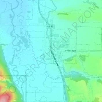
Name: Topografische Karte Thayne, Höhe, Relief.
Ort: Thayne, Lincoln County, Wyoming, 83127, United States (42.90253 -111.01238 42.93177 -110.97281)
Durchschnittliche Höhe: 1.814 m
Minimale Höhe: 1.783 m
Maximale Höhe: 1.961 m
Andere topografische Karten
Klicken Sie auf eine Karte, um ihre Topografie, ihre Höhe und ihr Relief anzuzeigen.