
Topografische Karte Golts
Interaktive Karte
Klicken Sie auf die Karte, um die Höhe anzuzeigen.
Über diese Karte
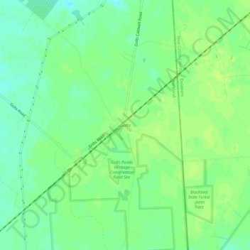
Name: Topografische Karte Golts, Höhe, Relief.
Ort: Golts, Kent County, Maryland, United States (39.31678 -75.79466 39.35678 -75.75466)
Durchschnittliche Höhe: 22 m
Minimale Höhe: 14 m
Maximale Höhe: 27 m
Andere topografische Karten
Klicken Sie auf eine Karte, um ihre Topografie, ihre Höhe und ihr Relief anzuzeigen.
Still Pond
United States > Maryland > Kent County
Still Pond, Kent County, Maryland, 21667, United States
Durchschnittliche Höhe: 21 m
Langford Bay Estates
United States > Maryland > Kent County
Langford Bay Estates, Kent County, Maryland, United States
Durchschnittliche Höhe: 4 m