Geolokalisieren

Topografische Karten Albury

Klicken Sie auf eine Karte, um ihre Topografie, ihre Höhe und ihr Relief anzuzeigen.

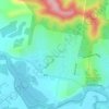
One Tree Hill

Australia > New South Wales > Albury

Durchschnittliche Höhe: 274 m

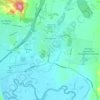
Nail Can Hill

Australia > New South Wales > Albury

Durchschnittliche Höhe: 223 m

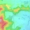
Hamilton Hill

Australia > New South Wales > Albury

Durchschnittliche Höhe: 352 m

Splitters Creek

Australia > New South Wales > Albury

The Splitters Creek valley is classed as a very high fire risk by the NSW Rural Fire Service (one of two in NSW) due to the topography and the access with only 1 road in and out.

Durchschnittliche Höhe: 214 m
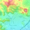
Lavington

Australia > New South Wales > Albury

Durchschnittliche Höhe: 247 m

North Albury

Australia > New South Wales > Albury

Durchschnittliche Höhe: 179 m

West Albury

Australia > New South Wales > Albury

Durchschnittliche Höhe: 194 m

Thurgoona

Australia > New South Wales > Albury

Durchschnittliche Höhe: 193 m

Morningside Place Playground

Australia > New South Wales > Albury

Durchschnittliche Höhe: 191 m

Albury

Australia > New South Wales > Albury

Durchschnittliche Höhe: 183 m

Norris Park Bush Easement

Australia > New South Wales > Albury

Durchschnittliche Höhe: 239 m

Rüsten Sie sich für Ihr nächstes Abenteuer:

🧊Kleine Kühltasche - Kompakte Tasche für frische Verpflegung unterwegs
🛡️Kniebandage für Wanderer - Unterstützung bei steilen Abstiegen und Gelenkproblemen
⛏️Kletterausrüstung - Grundausrüstung für Klettertouren
🚴Fahrradhelm - Schutzhelm für Radtouren
🥪Picknickset - Praktisches Set für Outdoor

Als Amazon-Partner verdient diese Website an qualifizierten Käufen, ohne dass Ihnen zusätzliche Kosten entstehen.