Geolokalisieren

Topografische Karten Setúbal

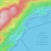
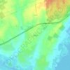
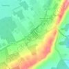
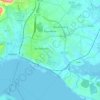
Klicken Sie auf eine Karte, um ihre Topografie, ihre Höhe und ihr Relief anzuzeigen.

Vila Fresca de Azeitão

Portugal > Setúbal > Setúbal

Durchschnittliche Höhe: 109 m

Aldeia de Irmãos

Portugal > Setúbal > Setúbal

Durchschnittliche Höhe: 100 m

Aldeia Grande

Portugal > Setúbal > Setúbal

Durchschnittliche Höhe: 103 m

Lapa de Santa Margarida

Portugal > Setúbal > Setúbal

Durchschnittliche Höhe: 105 m

Grelhal

Portugal > Setúbal > Setúbal

Durchschnittliche Höhe: 96 m

Mitrena

Portugal > Setúbal > Setúbal > Sado

Durchschnittliche Höhe: 7 m

Portinho da Arrábida

Portugal > Setúbal > Setúbal

Durchschnittliche Höhe: 133 m

Gâmbia

Portugal > Setúbal > Setúbal

Durchschnittliche Höhe: 16 m

Pontes

Portugal > Setúbal > Setúbal

Durchschnittliche Höhe: 13 m

Miradouro de São Sebastião

Portugal > Setúbal > Setúbal

Durchschnittliche Höhe: 17 m

Setúbal (São Sebastião)

Portugal > Setúbal > Setúbal

Durchschnittliche Höhe: 22 m

Picheleiros

Portugal > Setúbal > Setúbal

Durchschnittliche Höhe: 154 m

São Luís

Portugal > Setúbal > Setúbal

Durchschnittliche Höhe: 159 m

Forte de Santa Maria da Arrábida

Portugal > Setúbal > Setúbal

Durchschnittliche Höhe: 104 m

Aldeia Rica

Portugal > Setúbal > Setúbal

Durchschnittliche Höhe: 104 m

Alto da Guerra

Portugal > Setúbal > Setúbal

Durchschnittliche Höhe: 27 m

Formosinho

Portugal > Setúbal > Setúbal

Durchschnittliche Höhe: 244 m

Über diesen Ort

 •

Rüsten Sie sich für Ihr nächstes Abenteuer:

🔭Fernglas - Fernglas für Naturbeobachtung
🧢Outdoor Mütze - Schutz vor Sonne und Kälte
🗺️Wanderkarte Luxemburg - Detaillierte Karten für das Müllerthal und Éislek
🚁Kamera-Drohne - Spektakuläre Luftaufnahmen von Landschaften und Reliefs
🔌Powerbank - Externe Energie für GPS/Telefon

Als Amazon-Partner verdient diese Website an qualifizierten Käufen, ohne dass Ihnen zusätzliche Kosten entstehen.