

Topografische Karten Ireland
Klicken Sie auf eine Karte, um ihre Topografie, ihre Höhe und ihr Relief anzuzeigen.


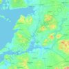


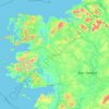























County Limerick
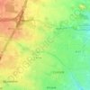
One possible meaning for the county's name in Irish Luimneach is "the flat area"; this description is accurate as the land consists mostly of a fertile limestone plain. Moreover, the county is ringed by mountains: the Slieve Felims to the northeast, the Galtees to the southeast, the Ballyhoura Mountains to the…
Durchschnittliche Höhe: 107 m


Über diesen Ort
County Cork • County Galway • County Dublin • County Kerry • County Mayo • County Donegal • County Meath • County Tipperary • County Wicklow • County Wexford • County Clare • County Limerick • County Kilkenny • County Kildare • County Waterford • County Westmeath • County Cavan • County Sligo • County Roscommon • County Laois • County Louth • County Offaly • County Leitrim • County Longford • County Monaghan • County Carlow • Dublin • The Municipal District of Cappamore — Kilmallock • The Municipal District of Birr • Cobh Municipal District • The Municipal District of Adare — Rathkeale • Letterkenny • Old Town • Sutton • Tallaght • Rosslare • Dernacartha • Glassan • Brosna • Carriganore • Murrintown • Tarbert • Shanbally • Rathdrum • Askamore • Manorcunningham • Naas • Clonakilty • Tramore • Kingscourt • Dunmore East • Kildare • Midleton • The Municipal District of Newcastle West • Portmarnock • Limerick • Carlow • Waterford • Galway City