Geolokalisieren

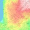
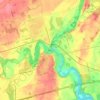
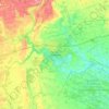
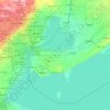
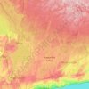
Topografische Karte Chatham-Kent

Klicken Sie auf die Karte, um die Höhe anzuzeigen.

Über diese Karte

Name: Topografische Karte Chatham-Kent, Höhe, Relief.

Ort: Chatham-Kent, Southwestern Ontario, Ontario, Canada (42.05986 -82.55163 42.65147 -81.62422)

Durchschnittliche Höhe: 183 m

Minimale Höhe: 169 m

Maximale Höhe: 232 m

Andere topografische Karten

Klicken Sie auf eine Karte, um ihre Topografie, ihre Höhe und ihr Relief anzuzeigen.
Toronto

Canada > Ontario > Toronto

Despite its deep ravines, Toronto is not remarkably hilly, but its elevation does increase steadily away from the lake. Elevation differences range from 76.5 metres (251 ft) above sea level at the Lake Ontario shore to 209 m (686 ft) ASL near the York University grounds in the city's north end at the…

Durchschnittliche Höhe: 113 m
London

Canada > Ontario > London > London

London has a humid continental climate (Köppen Dfb), though due to its downwind location relative to Lake Huron and elevation changes across the city, it is virtually on the Dfa/Dfb (hot summer) boundary favouring the former climate zone to the southwest of the confluence of the South and North Thames Rivers,…

Durchschnittliche Höhe: 268 m
Hamilton

Canada > Ontario > Hamilton

Durchschnittliche Höhe: 181 m

Crawford Lake

Canada > Ontario > Parry Sound District > Magnetawan

Durchschnittliche Höhe: 285 m

Kenora

Canada > Ontario

Durchschnittliche Höhe: 182 m

Haliburton

Canada > Ontario

Durchschnittliche Höhe: 358 m

Guelph

Canada > Ontario > Guelph

This region of Ontario has cold winters and warm, humid summers, falling into the Köppen climate classification Dfb zone, with moderately high rainfall and snowfall. It is generally a couple of degrees cooler than lower elevation regions on the Great Lakes shorelines, especially so in winter, the exception…

Durchschnittliche Höhe: 344 m
Cambridge

Canada > Ontario > Cambridge

Durchschnittliche Höhe: 295 m

Bowmanville

Canada > Ontario > Bowmanville

Durchschnittliche Höhe: 108 m

Niagara Escarpment

Canada > Ontario > Hamilton

Durchschnittliche Höhe: 162 m

Niagara Escarpment

Canada > Ontario

Durchschnittliche Höhe: 299 m

Peterborough

Canada > Ontario > Peterborough

Peterborough's topography is largely defined by land formations created by the receding Wisconsian glaciers 10,000–15,000 years ago. The South End and Downtown portions of the City sit on what was the bottom of the glacial Lake Peterborough—part of a glacial spillway created when glacial meltwaters from…

Durchschnittliche Höhe: 235 m

Algoma Mills

Canada > Ontario > Algoma District > The North Shore Township

Durchschnittliche Höhe: 183 m
Muskoka River

Canada > Ontario > Muskoka District > Bracebridge

Durchschnittliche Höhe: 246 m

Mount Nemo

Canada > Ontario > Halton Region > Burlington

Durchschnittliche Höhe: 248 m

Windsor

Canada > Ontario > Windsor

Durchschnittliche Höhe: 185 m

Quetico Provincial Park

Canada > Ontario

Durchschnittliche Höhe: 432 m

Perth

Canada > Ontario

Durchschnittliche Höhe: 313 m

Wiarton

Canada > Ontario > Bruce County

Durchschnittliche Höhe: 205 m

New Hamburg

Canada > Ontario > Region of Waterloo > Wilmot

Durchschnittliche Höhe: 351 m

Val Thérèse

Canada > Ontario > Sudbury District > Greater Sudbury

Durchschnittliche Höhe: 291 m

Dacre Heights

Canada > Ontario > Greater Madawaska

Durchschnittliche Höhe: 278 m

Arthur

Canada > Ontario > Wellington County > Wellington North

Durchschnittliche Höhe: 460 m

McFarlane Lake

Canada > Ontario > Sudbury District > Greater Sudbury

Durchschnittliche Höhe: 255 m

Kingston

Canada > Ontario > Kingston

Durchschnittliche Höhe: 94 m

Riverdale Park East

Canada > Ontario > Toronto

Durchschnittliche Höhe: 98 m

Paris

Canada > Ontario > Brant County

Durchschnittliche Höhe: 258 m

La Cloche Mountains

Canada > Ontario > Sudbury District > Killarney

Durchschnittliche Höhe: 255 m

London

Canada > Ontario

London has a humid continental climate (Köppen Dfb), though due to its downwind location relative to Lake Huron and elevation changes across the city, it is virtually on the Dfa/Dfb (hot summer) boundary favouring the former climate zone to the southwest of the confluence of the South and North Thames Rivers,…

Durchschnittliche Höhe: 269 m

Coboconk

Canada > Ontario > Kawartha Lakes

Durchschnittliche Höhe: 275 m

Wabos

Canada > Ontario > Algoma District > Unorganized North Algoma

Durchschnittliche Höhe: 336 m

Brantford

Canada > Ontario > Brantford

Durchschnittliche Höhe: 238 m

Prince Edward

Canada > Ontario

Durchschnittliche Höhe: 118 m

Lambton

Canada > Ontario

Durchschnittliche Höhe: 188 m

Parry Sound

Canada > Ontario

Durchschnittliche Höhe: 235 m

Essex

Canada > Ontario

Durchschnittliche Höhe: 193 m

Lac Seul

Canada > Ontario

Durchschnittliche Höhe: 365 m

Rattlesnake Point

Canada > Ontario > Milton

Durchschnittliche Höhe: 244 m

Scarborough Bluffs

Canada > Ontario > Toronto

Durchschnittliche Höhe: 120 m

Harlem Shoal

Canada > Ontario

Durchschnittliche Höhe: 175 m

St. Johns

Canada > Ontario

Durchschnittliche Höhe: 205 m

Ottawa

Canada > Ontario > Ottawa > Ottawa

Durchschnittliche Höhe: 99 m

The Arboretum

Canada > Ontario > Guelph

Victoria Woods is an old-growth hardwood forest made up of sugar maple, white ash, black cherry and beech. Varied topography in this area, which includes a pond, allows for a wide variety of woodland plants to grow here. Spring is an especially nice time to visit Victoria Woods to see many of these spring…

Durchschnittliche Höhe: 332 m
Ohsweken

Canada > Ontario

Durchschnittliche Höhe: 208 m

Sagamok

Canada > Ontario

Durchschnittliche Höhe: 210 m

Pinehurst Lake

Canada > Ontario

Durchschnittliche Höhe: 295 m

Docker Lake

Canada > Ontario

Durchschnittliche Höhe: 377 m

Oneida Nation of the Thames

Canada > Ontario

Durchschnittliche Höhe: 224 m

Bigwin Island

Canada > Ontario

Durchschnittliche Höhe: 328 m

Upper Pergeon Lake

Canada > Ontario

Durchschnittliche Höhe: 215 m

York River

Canada > Ontario

Durchschnittliche Höhe: 397 m

Kawartha Lakes (city)

Canada > Ontario

Durchschnittliche Höhe: 274 m

Fonthill

Canada > Ontario > Niagara Region

Durchschnittliche Höhe: 190 m

Pelee Island

Canada > Ontario

Durchschnittliche Höhe: 173 m

Quinte West (city)

Canada > Ontario

Durchschnittliche Höhe: 160 m

Lambton

Canada > Ontario

Durchschnittliche Höhe: 191 m

Algoma District

Canada > Ontario

Durchschnittliche Höhe: 360 m

London (city)

Canada > Ontario

Durchschnittliche Höhe: 239 m

Queenston

Canada > Ontario > Niagara Region > Niagara-on-the-Lake

Durchschnittliche Höhe: 133 m

Belleville

Canada > Ontario > Belleville

Durchschnittliche Höhe: 107 m

Quinte West

Canada > Ontario > Quinte West

Durchschnittliche Höhe: 110 m

Pickerel River

Canada > Ontario > Unorganized Centre Parry Sound

Durchschnittliche Höhe: 256 m

Elliott's Lake

Canada > Ontario > Region of Waterloo > North Dumfries

Durchschnittliche Höhe: 307 m

Calabogie

Canada > Ontario > Renfrew County > Greater Madawaska

Durchschnittliche Höhe: 163 m

King City

Canada > Ontario > York Region > King

Durchschnittliche Höhe: 302 m

Marmora

Canada > Ontario > Hastings County > Marmora and Lake

Durchschnittliche Höhe: 200 m

St. Thomas

Canada > Ontario > St. Thomas

Durchschnittliche Höhe: 231 m

Ayr

Canada > Ontario > Region of Waterloo > North Dumfries

Durchschnittliche Höhe: 298 m

Beamsville

Canada > Ontario > Niagara Region

Durchschnittliche Höhe: 134 m

High Park

Canada > Ontario > Toronto

Durchschnittliche Höhe: 97 m

Branchton

Canada > Ontario > Region of Waterloo > North Dumfries

Durchschnittliche Höhe: 271 m

Jacobs Landing

Canada > Ontario > Region of Waterloo > Cambridge

Durchschnittliche Höhe: 307 m

Wingham

Canada > Ontario > Huron County > North Huron

Durchschnittliche Höhe: 318 m

Kennaway

Canada > Ontario > Haliburton County > Dysart et al

Durchschnittliche Höhe: 390 m

Elmsdale Park

Canada > Ontario > Region of Waterloo > Kitchener

Durchschnittliche Höhe: 338 m

Thornbury

Canada > Ontario > Grey County

Durchschnittliche Höhe: 202 m

Don River

Canada > Ontario > Toronto

Durchschnittliche Höhe: 80 m

Rockwood

Canada > Ontario > Wellington County > Guelph/Eramosa

Durchschnittliche Höhe: 364 m

Bobcaygeon

Canada > Ontario > Kawartha Lakes

Durchschnittliche Höhe: 262 m

Vineland

Canada > Ontario > Niagara Region > Lincoln

Durchschnittliche Höhe: 123 m

Midhurst

Canada > Ontario > Simcoe County > Springwater

Durchschnittliche Höhe: 255 m

Thunder Beach

Canada > Ontario > Simcoe County > Tiny

Durchschnittliche Höhe: 218 m

Bloomingdale

Canada > Ontario > Region of Waterloo > Woolwich

Durchschnittliche Höhe: 324 m

Point Abino

Canada > Ontario > Niagara Region > Fort Erie

Durchschnittliche Höhe: 173 m

Manotick

Canada > Ontario > Ottawa

Durchschnittliche Höhe: 91 m

Mannheim

Canada > Ontario > Region of Waterloo > Wilmot > Mannheim

Durchschnittliche Höhe: 358 m

Chippawa

Canada > Ontario > Niagara Region > Niagara Falls > Chippawa

Durchschnittliche Höhe: 174 m

Buckham's Bay West

Canada > Ontario > Ottawa

Durchschnittliche Höhe: 79 m

Stevensville

Canada > Ontario > Niagara Region > Fort Erie > Stevensville

Durchschnittliche Höhe: 178 m

Baden

Canada > Ontario > Region of Waterloo > Wilmot

Durchschnittliche Höhe: 358 m

Kilmarnock

Canada > Ontario > Lanark County > Montague

Durchschnittliche Höhe: 110 m

St. Jacobs

Canada > Ontario > Region of Waterloo > Woolwich

Durchschnittliche Höhe: 341 m

Georgian Bay

Canada > Ontario > Parry Sound District > Carling Township

Durchschnittliche Höhe: 175 m

Rüsten Sie sich für Ihr nächstes Abenteuer:

🍫Outdoor Lebensmittel - Lang haltbare Nahrung
🌲Waldführer Bücher - Naturführer für Wanderer
⛏️Kletterausrüstung - Grundausrüstung für Klettertouren
🧵Reparaturset Outdoor - Flickzeug & Nähset
🚴Fahrradhelm - Schutzhelm für Radtouren

Als Amazon-Partner verdient diese Website an qualifizierten Käufen, ohne dass Ihnen zusätzliche Kosten entstehen.