
Topografische Karte Millwood
Interaktive Karte
Klicken Sie auf die Karte, um die Höhe anzuzeigen.
Über diese Karte
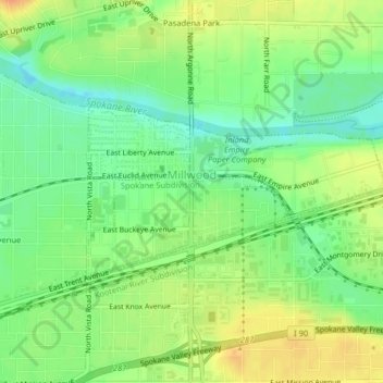
Name: Topografische Karte Millwood, Höhe, Relief.
Ort: Millwood, Spokane County, Washington, United States (47.67891 -117.29348 47.69092 -117.26233)
Durchschnittliche Höhe: 600 m
Minimale Höhe: 582 m
Maximale Höhe: 619 m
The topography of the city is mostly flat as it lies on the floor of the Spokane Valley, though it does slope gently down towards the north. The northern edge of town is defined by the Spokane River, where the terrain promptly drops about 20 feet down to the river bank.
Andere topografische Karten
Klicken Sie auf eine Karte, um ihre Topografie, ihre Höhe und ihr Relief anzuzeigen.
Spokane
United States > Washington > Spokane County
Spokane, Spokane County, Washington, United States
Durchschnittliche Höhe: 655 m
Newman Lake
United States > Washington > Spokane County
Newman Lake, Spokane County, Washington, 99025, United States
Durchschnittliche Höhe: 661 m
Hog Lake
United States > Washington > Spokane County
Hog Lake, Spokane County, Washington, United States
Durchschnittliche Höhe: 664 m
Silver Lake
United States > Washington > Spokane County
Silver Lake, Spokane County, Washington, 99022, United States
Durchschnittliche Höhe: 741 m
Mead
United States > Washington > Spokane County
Mead, Spokane County, Washington, 99021, United States
Durchschnittliche Höhe: 585 m
Country Homes
United States > Washington > Spokane County
Country Homes, Spokane County, Washington, 99251, United States
Durchschnittliche Höhe: 599 m
Airway Heights
United States > Washington > Spokane County
Airway Heights, Spokane County, Washington, 99001, United States
Durchschnittliche Höhe: 724 m
Cheney
United States > Washington > Spokane County
Cheney, Spokane County, Washington, United States
Durchschnittliche Höhe: 728 m
Deer Park
United States > Washington > Spokane County
Deer Park, Spokane County, Washington, 99006, United States
Durchschnittliche Höhe: 658 m
Mount Spokane
United States > Washington > Spokane County
Mount Spokane, Spokane County, Washington, United States
Durchschnittliche Höhe: 1.475 m
Liberty Lake
United States > Washington > Spokane County
Liberty Lake, Spokane County, Washington, 99019, United States
Durchschnittliche Höhe: 644 m
Spokane Valley
United States > Washington > Spokane County
Spokane Valley, Spokane County, Washington, United States
Durchschnittliche Höhe: 673 m
Nine Mile Falls
United States > Washington > Spokane County
Nine Mile Falls, Spokane County, Washington, 99026, United States
Durchschnittliche Höhe: 536 m
Riverside State Park
United States > Washington > Spokane County > Spokane
Riverside State Park, Spokane, Spokane County, Washington, United States
Durchschnittliche Höhe: 645 m
Medical Lake
United States > Washington > Spokane County
Medical Lake, Spokane County, Washington, 99022, United States
Durchschnittliche Höhe: 738 m
Medical Lake
United States > Washington > Spokane County > Medical Lake > Medical Lake
Medical Lake, Spokane County, Washington, 99022, United States
Durchschnittliche Höhe: 747 m
Chattaroy
United States > Washington > Spokane County > Chattaroy
Chattaroy, Spokane County, Washington, 99005, United States
Durchschnittliche Höhe: 559 m