
Topografische Karte Yarinacocha
Interaktive Karte
Klicken Sie auf die Karte, um die Höhe anzuzeigen.
Über diese Karte
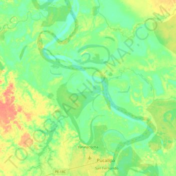
Name: Topografische Karte Yarinacocha, Höhe, Relief.
Ort: Yarinacocha, Province of Coronel Portillo, Ucayali, Peru (-8.41434 -74.78053 -8.05197 -74.51276)
Durchschnittliche Höhe: 144 m
Minimale Höhe: 132 m
Maximale Höhe: 169 m
Andere topografische Karten
Klicken Sie auf eine Karte, um ihre Topografie, ihre Höhe und ihr Relief anzuzeigen.
Province of Coronel Portillo
Province of Coronel Portillo, Ucayali, Peru
Durchschnittliche Höhe: 253 m
Río Ucayali
Río Ucayali, Iparía, Province of Coronel Portillo, Ucayali, Peru
Durchschnittliche Höhe: 161 m