Geolokalisieren

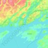
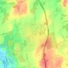
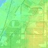
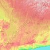
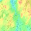
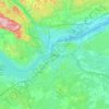
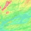
Topografische Karte Barrie

Klicken Sie auf die Karte, um die Höhe anzuzeigen.

Barrie

On September 7, 1977, a private aircraft, flown by "Army" Hollingsworth, dropped altitude to 500 feet (152 m) in dense fog and struck CKVR's 1,000-foot (305 m) transmitter tower, killing all five people aboard the plane and destroying the tower and antenna. The station's 225-foot (69 m) auxiliary tower was also destroyed with damage to the main studio building. CKVR returned to the air on September 19 at a reduced power of 40,000 watts until a new 1,000-foot (305 m) tower was built in 1978.

Wikipedia (CC-BY-SA 3.0)

Über diese Karte

Name: Topografische Karte Barrie, Höhe, Relief.

Ort: Barrie, Central Ontario, Ontario, Canada (44.29375 -79.74560 44.42459 -79.58591)

Durchschnittliche Höhe: 265 m

Minimale Höhe: 212 m

Maximale Höhe: 322 m

Andere topografische Karten

Klicken Sie auf eine Karte, um ihre Topografie, ihre Höhe und ihr Relief anzuzeigen.
Toronto

Canada > Ontario > Toronto

Despite its deep ravines, Toronto is not remarkably hilly, but its elevation does increase steadily away from the lake. Elevation differences range from 76.5 metres (251 ft) above sea level at the Lake Ontario shore to 209 m (686 ft) ASL near the York University grounds in the city's north end at the…

Durchschnittliche Höhe: 113 m
London

Canada > Ontario > London > London

London has a humid continental climate (Köppen Dfb), though due to its downwind location relative to Lake Huron and elevation changes across the city, it is virtually on the Dfa/Dfb (hot summer) boundary favouring the former climate zone to the southwest of the confluence of the South and North Thames Rivers,…

Durchschnittliche Höhe: 268 m
Hamilton

Canada > Ontario > Hamilton

Durchschnittliche Höhe: 181 m

Kingston

Canada > Ontario > Kingston

Durchschnittliche Höhe: 94 m

Windsor

Canada > Ontario > Windsor

Durchschnittliche Höhe: 185 m

Minden

Canada > Ontario > Haliburton County > Minden Hills

Durchschnittliche Höhe: 320 m

Cambridge

Canada > Ontario > Cambridge

Durchschnittliche Höhe: 295 m

Prince Edward Island

Canada > Ontario > Parry Sound District > Kearney

Durchschnittliche Höhe: 394 m

Guelph

Canada > Ontario > Guelph

This region of Ontario has cold winters and warm, humid summers, falling into the Köppen climate classification Dfb zone, with moderately high rainfall and snowfall. It is generally a couple of degrees cooler than lower elevation regions on the Great Lakes shorelines, especially so in winter, the exception…

Durchschnittliche Höhe: 344 m
Niagara Escarpment

Canada > Ontario

Durchschnittliche Höhe: 299 m

Haliburton

Canada > Ontario

Durchschnittliche Höhe: 358 m

Peterborough

Canada > Ontario > Peterborough

Peterborough's topography is largely defined by land formations created by the receding Wisconsian glaciers 10,000–15,000 years ago. The South End and Downtown portions of the City sit on what was the bottom of the glacial Lake Peterborough—part of a glacial spillway created when glacial meltwaters from…

Durchschnittliche Höhe: 235 m

Blue Mountain

Canada > Ontario > Timiskaming District > Kirkland Lake

Durchschnittliche Höhe: 346 m

Paris

Canada > Ontario > Brant County

Durchschnittliche Höhe: 258 m

Silver Creek Park

Canada > Ontario > Toronto

Durchschnittliche Höhe: 152 m

Kenora

Canada > Ontario

Durchschnittliche Höhe: 182 m

Whitney

Canada > Ontario > Nipissing District > South Algonquin Township

Durchschnittliche Höhe: 410 m
St. Thomas

Canada > Ontario > St. Thomas

Durchschnittliche Höhe: 231 m

Otonabee River

Canada > Ontario > Peterborough

Durchschnittliche Höhe: 197 m

High Park

Canada > Ontario > Toronto

Durchschnittliche Höhe: 97 m

Saugeen River

Canada > Ontario > Grey Highlands

Durchschnittliche Höhe: 514 m

Alliston

Canada > Ontario > Simcoe County

Durchschnittliche Höhe: 233 m

Madawaska River

Canada > Ontario > Renfrew County > Greater Madawaska > Calabogie

Durchschnittliche Höhe: 160 m

Sharon

Canada > Ontario > York Region

Durchschnittliche Höhe: 268 m

Don River

Canada > Ontario > Old Toronto

Durchschnittliche Höhe: 90 m

Newtonville

Canada > Ontario > Durham Region > Clarington

Durchschnittliche Höhe: 154 m

Laclu

Canada > Ontario > Kenora District > Unorganized Kenora District

Durchschnittliche Höhe: 327 m

Prince Edward

Canada > Ontario

Durchschnittliche Höhe: 118 m

Kawartha Lakes

Canada > Ontario > Kawartha Lakes

Durchschnittliche Höhe: 269 m

Perth

Canada > Ontario

Durchschnittliche Höhe: 313 m

Lambton

Canada > Ontario

Durchschnittliche Höhe: 188 m

Parry Sound

Canada > Ontario

Durchschnittliche Höhe: 235 m

Essex

Canada > Ontario

Durchschnittliche Höhe: 193 m

Lac Seul

Canada > Ontario

Durchschnittliche Höhe: 365 m

Scarborough Bluffs

Canada > Ontario > Toronto

Durchschnittliche Höhe: 120 m

Harlem Shoal

Canada > Ontario

Durchschnittliche Höhe: 175 m

St. Johns

Canada > Ontario

Durchschnittliche Höhe: 205 m

Niagara Escarpment

Canada > Ontario > Burlington

Durchschnittliche Höhe: 216 m

Quetico Provincial Park

Canada > Ontario

Durchschnittliche Höhe: 432 m

Woodstock

Canada > Ontario > Woodstock

Durchschnittliche Höhe: 306 m

Niagara Escarpment

Canada > Ontario > Hamilton

Durchschnittliche Höhe: 162 m

Ohsweken

Canada > Ontario

Durchschnittliche Höhe: 208 m

Pinehurst Lake

Canada > Ontario

Durchschnittliche Höhe: 295 m

Docker Lake

Canada > Ontario

Durchschnittliche Höhe: 377 m

Oneida Nation of the Thames

Canada > Ontario

Durchschnittliche Höhe: 224 m

Bigwin Island

Canada > Ontario

Durchschnittliche Höhe: 328 m

Upper Pergeon Lake

Canada > Ontario

Durchschnittliche Höhe: 215 m

York River

Canada > Ontario

Durchschnittliche Höhe: 397 m

Kawartha Lakes (city)

Canada > Ontario

Durchschnittliche Höhe: 274 m

Pelee Island

Canada > Ontario

Durchschnittliche Höhe: 173 m

Kendal

Canada > Ontario > Durham Region > Clarington

Durchschnittliche Höhe: 221 m

Quinte West (city)

Canada > Ontario

Durchschnittliche Höhe: 160 m

London

Canada > Ontario

London has a humid continental climate (Köppen Dfb), though due to its downwind location relative to Lake Huron and elevation changes across the city, it is virtually on the Dfa/Dfb (hot summer) boundary favouring the former climate zone to the southwest of the confluence of the South and North Thames Rivers,…

Durchschnittliche Höhe: 269 m

Lambton

Canada > Ontario

Durchschnittliche Höhe: 191 m

Algoma District

Canada > Ontario

Durchschnittliche Höhe: 360 m

London (city)

Canada > Ontario

Durchschnittliche Höhe: 239 m

Lindsay

Canada > Ontario > Kawartha Lakes

Durchschnittliche Höhe: 268 m

Gull Lake

Canada > Ontario > Haliburton County > Minden Hills

Durchschnittliche Höhe: 281 m

Coulter Lake

Canada > Ontario > Haliburton County > Algonquin Highlands

Durchschnittliche Höhe: 357 m

Downsview Park

Canada > Ontario > Toronto

Durchschnittliche Höhe: 186 m

Irondale

Canada > Ontario > Haliburton County > Minden Hills

Durchschnittliche Höhe: 331 m

Beamsville

Canada > Ontario > Niagara Region

Durchschnittliche Höhe: 134 m

Riverdale Park East

Canada > Ontario > Toronto

Durchschnittliche Höhe: 98 m

Harold Town Park

Canada > Ontario > Toronto

Durchschnittliche Höhe: 119 m

Picton

Canada > Ontario > Prince Edward County

Durchschnittliche Höhe: 112 m

Muskoka River

Canada > Ontario > Muskoka District > Bracebridge

Durchschnittliche Höhe: 246 m

Ottawa

Canada > Ontario > Ottawa > Ottawa

Durchschnittliche Höhe: 99 m

Griffith

Canada > Ontario > Renfrew County > Greater Madawaska

Durchschnittliche Höhe: 292 m

Don River

Canada > Ontario > Toronto

Durchschnittliche Höhe: 80 m

Grand Bend

Canada > Ontario > Lambton County > Lambton Shores

Durchschnittliche Höhe: 183 m

Morningside Park

Canada > Ontario > Toronto

Durchschnittliche Höhe: 133 m

MacTier

Canada > Ontario > Muskoka District > Georgian Bay Township

Durchschnittliche Höhe: 241 m
Keswick

Canada > Ontario > York Region

Keswick's geographical coordinates are 44.22°N, 79.45°W, and its elevation above sea level is 221m/762 ft. It has a geographical area of 16.25 km² according to Statistics Canada. It is bound on the north by Roches Point, the east by Woodbine Avenue, the south by East Gwillimbury (Ravenshoe Road) and the…

Durchschnittliche Höhe: 228 m

Larder Lake

Canada > Ontario > Timiskaming District > Larder Lake Township

Durchschnittliche Höhe: 300 m

Crawford Lake

Canada > Ontario > Parry Sound District > Magnetawan

Durchschnittliche Höhe: 285 m

Fonthill

Canada > Ontario > Niagara Region

Durchschnittliche Höhe: 190 m

Benny

Canada > Ontario > Sudbury District > Unorganized North Sudbury

Durchschnittliche Höhe: 402 m

Baltimore

Canada > Ontario > Northumberland County > Hamilton Township

Durchschnittliche Höhe: 176 m

Iona

Canada > Ontario > Elgin County > Dutton/Dunwich

Durchschnittliche Höhe: 212 m

Cooper Point

Canada > Ontario > Muskoka District > Muskoka Lakes Township

Durchschnittliche Höhe: 230 m

Prescott

Canada > Ontario > Prescott

Durchschnittliche Höhe: 89 m

Janetville

Canada > Ontario > Kawartha Lakes

Durchschnittliche Höhe: 276 m

Belleville

Canada > Ontario > Belleville

Durchschnittliche Höhe: 107 m

Brantford

Canada > Ontario > Brantford

Durchschnittliche Höhe: 238 m

Brockville

Canada > Ontario > Brockville

Durchschnittliche Höhe: 103 m

Cornwall

Canada > Ontario > Cornwall

Durchschnittliche Höhe: 67 m

Orillia

Canada > Ontario > Orillia

Durchschnittliche Höhe: 236 m

Quinte West

Canada > Ontario > Quinte West

Durchschnittliche Höhe: 110 m

Stratford

Canada > Ontario > Stratford

Durchschnittliche Höhe: 356 m

Montreal River

Canada > Ontario > Unorganized West Timiskaming

Durchschnittliche Höhe: 301 m

French River

Canada > Ontario > Sudbury District

Durchschnittliche Höhe: 208 m

Pickerel River

Canada > Ontario > Unorganized Centre Parry Sound

Durchschnittliche Höhe: 256 m

Chalk River

Canada > Ontario > Laurentian Hills

Durchschnittliche Höhe: 201 m

Rüsten Sie sich für Ihr nächstes Abenteuer:

😴Isomatte selbstaufblasend - Hoher Schlafkomfort auf unebenem Boden
🪓Multitool - Vielseitiges Werkzeug für Outdoor
⌚Sportuhr mit Barometer - Überwachung von Höhe, Luftdruck und Wetterumschwüngen
📱Handyhalterung Fahrrad - Smartphone sicher als Navi am Lenker nutzen
🥾Wanderstiefel - Wasserdichte Stiefel für anspruchsvolle Trails

Als Amazon-Partner verdient diese Website an qualifizierten Käufen, ohne dass Ihnen zusätzliche Kosten entstehen.