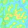
Topografische Karte Kulathupuzha
Klicken Sie auf die Karte, um die Höhe anzuzeigen.
Über diese Karte

Name: Topografische Karte Kulathupuzha, Höhe, Relief.
Ort: Kulathupuzha, Punalur, Kollam, Kerala, 691541, India (8.80393 77.04247 8.91548 77.14342)
Durchschnittliche Höhe: 226 m
Minimale Höhe: 103 m
Maximale Höhe: 945 m
Andere topografische Karten
Klicken Sie auf eine Karte, um ihre Topografie, ihre Höhe und ihr Relief anzuzeigen.

Wayanad
Wayanad (IPA: [ʋɐjɐnaːɖɨ̆]) is a district in the north-east of Indian state Kerala with administrative headquarters at the municipality of Kalpetta. It is the only plateau in Kerala. The Wayanad Plateau forms a continuation of the Mysore Plateau, the southern portion of Deccan Plateau. It is set high in…
Durchschnittliche Höhe: 724 m


Nilambur
The 2,554 m (8,379 ft) m high Mukurthi peak, which is situated in the border of Nilambur Taluk and Ooty Taluk, and is also the fifth-highest peak in South India as well as the third-highest in Kerala after Anamudi (2,696 m [8,845 ft]) and Meesapulimala (2,651 m [8,698 ft]), is the highest point of elevation in…
Durchschnittliche Höhe: 33 m
Thrippunithura
India > Kerala > Kanayannur
In the south, Thrippunithura borders the Vembanad, the longest lake in India. The lake provides facilities for inland water navigation, with the Champakkara canal stretch of the National Waterway 3 forming its western boundary with Kochi and Maradu. The canal then merges with the Chithrapuzha river in the…
Durchschnittliche Höhe: 8 m


Idukki
Though it is the second-largest district in the region in terms of area, it has the lowest population density among the districts of Kerala. There are only two municipalities in the district and the urban population is comparatively much lower than the rural population, due to its mountainous nature. The 2,695…
Durchschnittliche Höhe: 607 m
Thiruvananthapuram
India > Kerala > Thiruvananthapuram
Thiruvananthapuram is built on seven hills by the seashore and is at 8°30′N 76°54′E / 8.5°N 76.9°E / 8.5; 76.9 on the west coast, near the southern tip of mainland India. The city is on the west coast of India and is bounded by the Laccadive Sea to its west and the Western Ghats to its east.…
Durchschnittliche Höhe: 33 m
Western Ghats
The range starts near south of the Tapti river and runs approximately 1,600 km (990 mi) through the states of Gujarat, Maharashtra, Karnataka, Goa, Kerala and Tamil Nadu ending at Marunthuvazh Malai, Swamithope near the southern tip of India. These hills cover 160,000 km2 (62,000 sq mi) and form the catchment…
Durchschnittliche Höhe: 2.225 m
Sultan Bathery
India > Kerala > Sulthanbathery
Sulthan Bathery is located at 11°40′N 76°17′E / 11.67°N 76.28°E / 11.67; 76.28. It has an average elevation of 907 m (2,976 ft).
Durchschnittliche Höhe: 876 m

Pathanamthitta
The district can be divided into three natural geographical regions: the highland, the midland and the lowland. The highland stretches through the Western Ghats, where the hills are tall and covered with thick forests. Western Ghats maintains an average altitude of around 800 m. It descends to the smaller…
Durchschnittliche Höhe: 390 m


Palakkad
Palakkad district (Malayalam: [pɐːlɐkːɐːɖɨ̆] ) is one of the 14 districts in the Indian state of Kerala. It was carved out of the southeastern region of the former Malabar District on 1 January 1957. It is located at the central region of Kerala and is the second largest district in the state after…
Durchschnittliche Höhe: 306 m


Alappuzha
The Vembanad lake, which lies below the sea level, is the longest lake in the Indian peninsula, and the district of Alappuzha lies between this lake and the Arabian Sea. Kuttanad region of the Alappuzha district, which lies below the sea level, is the point of least elevation in the entire India. Kuttanad,…
Durchschnittliche Höhe: 21 m


Pathanamthitta
Pathanamthitta has an average elevation of 18 metres (62 ft) above sea level.
Durchschnittliche Höhe: 63 m
Thiruvananthapuram
India > Kerala > Thiruvananthapuram
Thiruvananthapuram is built on seven hills by the seashore and is at 8°30′N 76°54′E / 8.5°N 76.9°E / 8.5; 76.9 on the west coast, near the southern tip of mainland India. The city is on the west coast of India and is bounded by the Laccadive Sea to its west and the Western Ghats to its east.…
Durchschnittliche Höhe: 33 m

Malappuram
Bounded by Kozhikode district to the northwest, Wayanad district to the northeast, Nilgiri hills to the east, Palakkad district to the southeast, Thrissur district to the southwest, and Arabian Sea to the west, Malappuram has a total geographical area of 3,554 km2, which ranks third in the state in terms of…
Durchschnittliche Höhe: 224 m


Ernakulam
India > Kerala > Kanayannur
The Ernakulam District is situated in Central Kerala in India. Ernakulam is located at 9°59′N 76°17′E / 9.98°N 76.28°E / 9.98; 76.28. It has an average elevation of 4 m (13 ft).
Durchschnittliche Höhe: 6 m





Periyar
The southernmost part of the Cardamom Hills i.e. the source of Periyar River is a narrow valley extending south of Kumily. This is the southern extreme of the Periyar basin. It is less than 20 kilometres (12 mi) wide and is about 40 kilometres (25 mi) long. The upper catchments of Periyar extend as a wedge…
Durchschnittliche Höhe: 540 m


Ponkunnam
India > Kerala > Kanjirappally
Ponkunnam is a census town in Kerala, India, part of Kottayam district under Kanjirappally taluk. Ponkunnam literally means golden mountain (ponn = gold, kunn = mountain). Nearby towns are Kanjirappalli, Manimala and Pala. This part of Kerala is famous for its fertile land and rubber plantations. It is at an…
Durchschnittliche Höhe: 83 m





Kollam
Kallada Boat race is one of the famous festival events of the district. Even though it is a competition between two land sides of the river, many boat clubs from various places, even beyond the district participate in the event. Kollam is known as the capital of Kerala's cashew industry. Plains, mountains,…
Durchschnittliche Höhe: 203 m


Pamba River
The Pamba originates at Pulachimalai hill in the Peerumedu plateau in the Western Ghats at an altitude of 1,650 metres (5,410 ft). Starting from the Idukki district and traversing a distance of 176 kilometres (109 mi) through Pathanamthitta and Alappuzha districts, the river joins the Arabian Sea through a…
Durchschnittliche Höhe: 330 m






Kasaragod
The district is the northernmost district of the State of Kerala. Kasargod is located at 12°30′N 75°00′E / 12.5°N 75.0°E / 12.5; 75.0. It has an average elevation of 19 metres (62 feet). Ranipuram or Madathumala (1016m) peak is the highest peak in the Kasargod district of Kerala, located in…
Durchschnittliche Höhe: 127 m