Topografische Karte Scartaglen
Klicken Sie auf die Karte, um die Höhe anzuzeigen.
Über diese Karte

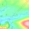
Name: Topografische Karte Scartaglen, Höhe, Relief.
Durchschnittliche Höhe: 135 m
Minimale Höhe: 51 m
Maximale Höhe: 258 m
Andere topografische Karten
Klicken Sie auf eine Karte, um ihre Topografie, ihre Höhe und ihr Relief anzuzeigen.
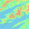

Killarney National Park
Killarney National Park is in southwest Ireland close to the island's most westerly point. The Lakes of Killarney and the Mangerton, Torc, Shehy and Purple Mountains are in the park. Altitudes in the park range from 22 metres (72 ft) to 842 metres (2,762 ft). A major geological boundary between Devonian Old…
Durchschnittliche Höhe: 212 m

Ardfert
A large tomb in the grounds of the cathedral was built much later by John O'Donnell (1803–1879), the most prominent descendant two centuries later, and whose own direct male descendant was the late Patrick Denis O'Donnell (1922–2005), the Irish military historian. He owned the summit overlooking Ardfert…
Durchschnittliche Höhe: 20 m

























Dingle
Dingle's St. Mary's is a neo-Gothic church built to designs by J. J. McCarthy and O'Connell. The foundation stone was laid in 1862. It originally had a nave and aisles separated by arcades, supported on columns capped by octagonal tops. The arcades were demolished in one of the most radical reordering schemes…
Durchschnittliche Höhe: 41 m